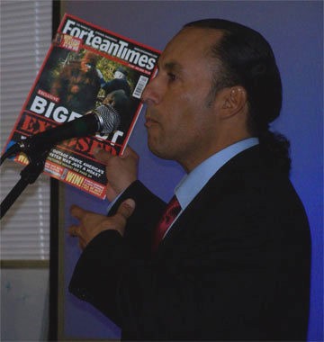
Cryptic News from the Willow Creek View. Transhuman Sasquatch Strangeness from the Middle of Nowhere.
A Voice Howling out from the Klamath-Trinity-Siskiyou Wilderness. This is the Megaphone of Steven Streufert and Bigfoot Books, a Used Book Store in Willow Creek, Humboldt County, Extreme Northern California.
If a little over four grand isn't raised by June 29th of this year the world-famous and much beloved BIGFOOT DISCOVERY MUSEUM may be closed and sold off on auction. Michael Rugg, the museum proprietor is a very dedicated guy who has put not only his heart and soul into this project, but also his life savings, car and home. He has never charged a dime for admission to one of the best Bigfoot-related collections around, nor for the knowledge he freely dispenses. YOU CAN HELP by donating, buying something, or visiting the place. But do it now, before it is too late. If you ever thought of visiting there, donate something and think of it as an investment in the future.
One truly great feature on the web site, http://bigfootdiscoveryproject.com/, is the three years' worth of the Discovery Project Newsletter. It is much like Daniel Perez' BIGFOOT TIMES in form, and is well worth downloading in PDF and reading... again, for free. They are full of Bigfooting gems. On YouTube you may find over 200 really great and informative editorial and commentary videos that feature Mike Rugg talking about the latest Bigfooting issues of the day. Check it out at... http://www.youtube.com/user/BigfootMuseum
There is not too much to buy in there right now, but the Museum does have an ONLINE STORE. Click the link. One thing we can highly recommend for kids and adults is Michael Rugg's BIGFOOT DISCOVERY COLORING AND ACTIVITY BOOK, available in the store. It's not only fun, but also educational. They have a great selection in their BIGFOOT T-SHIRT SHOP via CafePress. This is one of the easiest ways to help, sure to be popular with your entire Squatching familia. The shop also features mugs, posters, calendars, stationery, a wall clock, a teddy bear, fridge magnets, mouse pads and a journal book. The prices are a little high, but you can consider it a charitous purchase.
One good way to help out is to become a member. You can sign up HERE for that.
One of the shirts available through the online T-Shirt Store, this one
featuring a very cool image Mike Rugg drew of Patty Bigfoot,
with Roger Patterson and Bob Gimlin.
Here is an article on the matter which appeared recently in the Museum's local paper, The Santa Cruz Sentinel. Click the title to read the whole thing online.
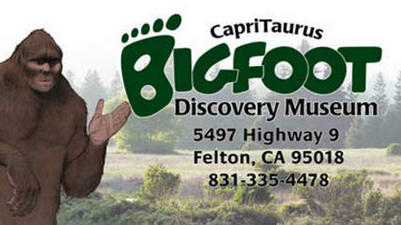
FELTON - Michael Rugg, owner of the Bigfoot Discovery Museum at 5497 Highway 9, was surprised to learn the county had set a deadline of June 29 for him to pay back taxes of $4,368 or see the property sold at auction.
He thought he had more time.
After seven years of operation and gaining local and international recognition, the museum sees 30 to 60 people a day in the summer.
Rugg says only now is he seeing revenue, and he had hoped a contact from a Hollywood producer could turn his Felton Bigfoot story into a reality television show. Meanwhile, a balloon payment on a loan he took out before the economy crashed will come due next year.
"Maybe people will rally and help us," Rugg said, noting the museum is open 11 a.m. to 6 p.m. every day but Tuesday.
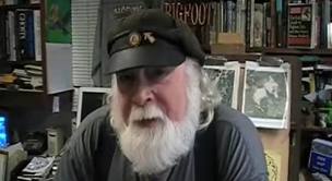
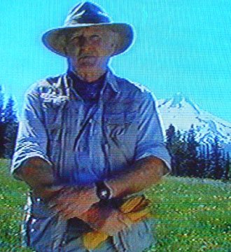
An Image of Mike at his Desk, from one of his online videos.
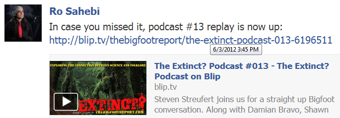
Here is a brief "Public Service Announcement" that I helped make (by being the guest on their show)on the EXTINCT Podcast with Ro Sahebi recently. Click the link below the image to view, or use the player box below if it will work in your browser.
Here is another thing, from the Museum's web site...
Seriously Seeking Sponsors
The Bigfoot Discovery Project is seeking help from a person or persons of means. We need additional funding to keep the Discovery Project operating at full speed.
Click here if interested but you need more convincing.
So, do what you can. Even just a visit to the spot and a few bucks in the pot will help. And you'll get more than you give if you get into a conversation with Mr. Rugg.
Here is a previous blog this site did on Michael Rugg:
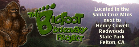
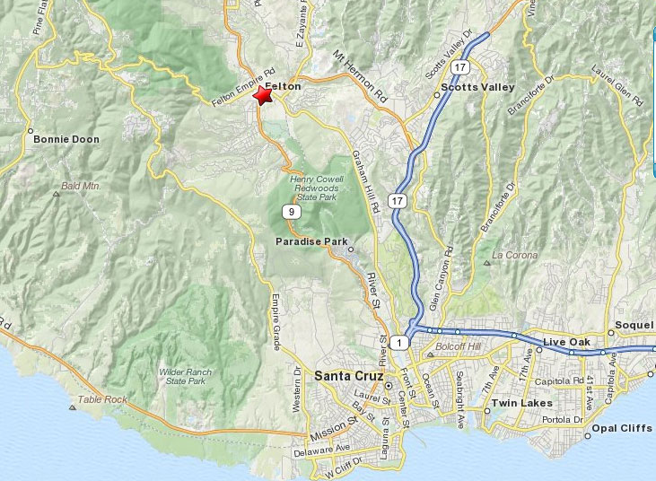
And HERE is a MAP of the Santa Cruz, CA area, which will help you get there...
The Road to Felton,
CLICK TO ENLARGE SIGNIFICANTLY.
*******
THE "EXTINCT?" PODCAST
Yesterday Yours Truly was the guest on the TeamTazer-associated EXTINCT? Podcast. It was a great conversation, an hour and about forty minutes of which was captured on the air. About an hour of the best stuff was off-air before and after the show. Anyway, now I am blacklisted for sure. Ms. Hovey has said that anyone associating with TeamTazer would be put on the shun list. Oh no! I will never Squatch in Salt Fork Community Park again!
The Extinct? Podcast, Episode #13. About this episode
Steven Streufert joins us for a straight up Bigfoot conversation. Along with Damian Bravo, Shawn Evidence, Michael Merchant and Ro Sahebi.
And... a Good Time Was Had by All.
*******
Are you an investor or interested in Bigfoot patronage? Here is the text of the proposal and business plan that Mike Rugg had a while back for the BIGFOOT DISCOVERY MUSEUM. I'm sure much of this still applies. Also, news is that Mike, his research, and the Museum will be featured in an upcoming television series that may even be all their own.
Michael Rugg and Paula Yarr started the project in 2003. The business plan called for the development of the BDP website and Bigfoot Discovery Museum, a roadside attraction designed to educate and entertain the public, and to generate revenue from sales of souvenir items, a bigfoot-oriented product line, and consigned local art and crafts. The goal was to create a fulltime research center and library— that would perpetuate itself through a cottage industry and memberships—dedicated to studying, and being instrumental in solving, the bigfoot problem. (Problem: People see “it”… science can’t adequately explain why.)
So far the project has been most successful in terms of the research, because as soon as the museum opened its doors to the public, the local bigfoot encounter stories started rolling in. Although we had planned to do occasional fieldwork, it was not the emphasis, as the principles expected to be tied down working in the museum and developing products and curriculum. But the stories were so compelling that they could not be ignored. As a result of time spent documenting local stories and researching local history, the emphasis of the project shifted towards fieldwork; the product line fell behind schedule, and the revenue stream has fallen short of being self-sustaining. For these reasons, we are currently seeking funding from outside sources.
Our plans for the future include attracting more members and volunteers, implementing the educational product line and developing curriculum, while setting up a local network of field observers and investigators in an attempt to locate or create a primate habituation scenario. The museum creation and the first four years of research have been funded out of pocket. (I personally have spent nearly all my time since 2003 developing the project as a full-time research and education center.)
Over the past 5 years my conviction that this is a worth-while and important pursuit has been proven to me time and time again through conversations with others who have personally experienced bigfoot, as well as other unexplained phenomena. The importance of scientific exploration has been firmly
established in my heart and mind after talking with dozens of young future cryptozoologists, and many intelligent adults who, like myself, are sick and tired of the scientific “establishment” explaining away things they can’t adequately explain, and the arrogant tendency to infer that all the eyewitnesses and experiencers are either fools or liars.
With adequate funding and more help, this project will pay its own way by generating profits from sales and services.
Market Indicators
For the sake of potential investors and/or benefactors here are some indicators of the current wave of bigfoot interest—unparalleled since the 1970’s—that has been building since the turn of the century:
• many overly ballyhooed media stories
• many new books both pro and con being published
• many out of print bigfoot titles being reprinted
• many old low budget films being released on compendium DVDs
• many new television treatments and documentaries (Travel, History, Discovery Channels)
• art exhibits in San Francisco, New York and London etc. featuring sasquatch inspired artwork
• dozens of new web sites devoted to mystery primates
• research organizations starting up all across the world/ dozens of Bigfoot blogs
• the remake of the blockbuster movie King Kong
• many new low budget Bigfoot movies being made (and some with bigger budgets in the works)
• dozens of hoaxed videos appearing on the Internet (including one by Penn & Teller)
• numerous conventions being held across the country (CA, WA, TX, PA, OK, ID)
• several new Bigfoot Museums appear (CA, WA, TX, ME, CO)
• many TV commercials featuring sasquatch
• exhibits at major museums (Vancouver, BC; San Antonio, TX; Pocatello, ID; Berkeley,CA)
• Bigfoot Safaris (people pay to go out in the forest at night looking for bigfoot)
• Bigfoot pay-per-view web casts
• Bigfoot reality TV shows currently in the making
• Google searches very high for Bigfoot, sasquatch and yeti
• Bigfoot Friday (8/15/08) the most publicized hoax in recent history (#1 international story)
The Bigfoot Discovery museum is in sight of the main entrance to Henry Cowell Redwood State Park which has over 400,000 visitors per year. Next to the park is Roaring Camp, both a narrow guage steam railroad an a full size deisel train to the beach/boardwalk in Santa Cruz. It also has 1000s of visitors a year. Not far away (9 miles as the crow flies) is the Mystery Spot, another international tourist attraction.
Demographics are across the board… all ages and races of people come to the area from all over the world.
We’ve had much unsolicited media coverage representing thousands of dollars worth of free publicity
o TV treatments
o Croatian TV magazine show
o Eye on the Bay (CBS-SF)
o Life in the 831 (KION-Monterey)
o Despierta America (Latin American morning show)
o The Great Outdoors (Australian travel show)
o California Postcard (Sacramento TV Ch10)
o Bo Selecta (comedy program in UK)
o Community TV in Mt View
o Newspapers & magazines
o SF Chronicle
o San Jose Mercury
o LA Times
o Santa Cruz Sentinel
o Budget Travel
o Via magazine
o Valley Press/Scotts Valley Banner
o Radio and internet radio interviews
o KSCO (Santa Cruz), Xzone (Canada), Seattle, Tennessee, Florida,
BIGFOOT DISCOVERY PROJECT SUMMARY MISSION
1. Attract & edutain the public with the facts about mystery primates around the world
2. Generate revenue to cover expenses, pay staff, fund ongoing projects & programs
3. Establish Research Center for Discovery Science & Scientific Exploration
4. Teach children about reverence for wildlife and conservation of wilderness via cryptozoology
5. Seek proof of the existence of Bigfoot via local field research and forensics
ACTIONS NEEDED TO FULFILL MISSION
Upgrade website & add online store
Complete the museum improvements & exhibits
-Bookstore/research room
-Outdoor classroom/ Theatre /Children’s Art project
ME EXTRA ANGRY TODAY! ANNOYING TWEET-TWEET BIRD COME AND THROW WORMS AT ANGRY BIGFOOT! SOMETIME ME WANT THROW BIGFOOT POO POO AT LITTLE BIRD. THEN BIGFOOT HUNTER JUST HAVE LOOK FOR POO POO COVERED TWEET-TWEET BIRD INSTEAD OF ANGRY BIGFOOT. I TALKING TO YOU BOBO, CLIFF RENAE AND MATT! ME NO LIKEY FINDING BIGFOOT! ****************************************************
This blog is copyright and all that jazz, save for occasional small
elements borrowed for "research" and information or satirical purposes
only, 2007-2012, Bigfoot Books and Steven Streufert. Borrowings for
non-commercial purposes will be tolerated without the revenge of Angry
Bigfoot, if notification, credit, citation and a kindly web-link are
given, preferably after contacting us and saying, Hello, like a normal
person would before taking a cup of salt. No serious rip-offs of our
material for vulgar commercial gain will be tolerated without major BF
stomping action coming down on you, hu-man.
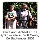
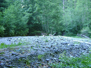
Over the weekend of June 26-28th "Crazy" Ian and yours truly, the Bigfoot Bookman, traveled up to Bluff Creek to investigate the Patterson-Gimlin bigfoot film timeline and film site. Many strange occurrences were encountered along the way, including the sighting of one of the largest black widow spiders ever seen in Ian's SUV. Unfortunately, those hundreds of cute baby spiders that had hatched from their egg sacks on the way up to camp were suddenly NOT so cute. The truck will have to be fumigated.
After a stop at the desolate Aikins Creek Camp-ground we headed up to Fish Lake for the night. It was crowded, and the only wood knocks and vocalizations heard were from the homo sapiens infesting the place over raucous campfires. The road up was perfect, save for a little dusting from this winter's mudslides. The lake, despite the crowds, was wonderful, half-covered in lily pads, the other half with fishing boats.
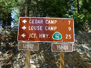
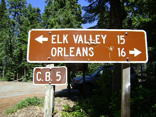
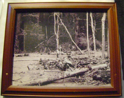
[Images, turnoff, 16 mi. up the G-O Road]
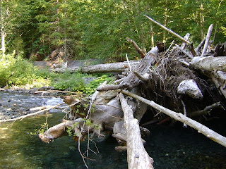
Having survived the spiders and humans, we headed down to the Orleans diner, and then up to the film site. Along the well-graded (compared to past years) 12N13, one of our cars (a Volkswagen Golf--NOT recommended!) lost its oil pan. Undaunted, we made our way down the "K-Spur" (count the pull-off spurs from 12N12, three on the right, one on the left, and the "K" is the fourth right, head downhill, not sideways). This rugged, often wretched, road is not to be traversed save in a truck with high clearance, preferably 4WD, and one that you don't mind getting all scratched up. The rockslide and marsh mud at the bottom were easily traversable That said, it was easy! But get the book-bound USFS topo atlas.
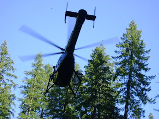
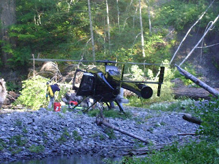
BLACK HELI- COPTERS! Yes, it was just like something from the Art Bell Show, or a paranoid right-wing conspiracy. Immediately upon arriving at the creekside we were buzzed twice by a black, apparently unmarked black helicopter. What strange things could the Men-in-Black be up to on the P-G Film Site??? After observing us it circled back and actually landed on the gravel bar on the west end, more or less where the Patterson film begins. Checking ourselves for anything illegal, we headed down through the bracken forest to the site a few hundred yards to below to the east.
Down there we met several guys who were not space aliens or covert agents, but from National Geographic's TV division. They were filming the site and scanning the topography of the environs to document and confirm the location. Look for their upcoming Bigfoot documentary to contain a first-generation copy of the film scanned at Patty Patterson's home in Yakima, WA. Each frame has been scanned at mega-high resolution, uncropped. They were not exactly sure they had the exact site located, as they had two GPS coordinates. Investigation, though, found pink plastic tape markers pretty much exactly at the start and finish of the film creature's course. They asked what we thought, and seemed well enough convinced of the Titmus-Dahinden-Perez connection for locating the film, not to mention the word of Bobo Fay and other next-generation squatchers. An aside mentioning of M.K. Davis' downstream location theory was not, however, appreciated.
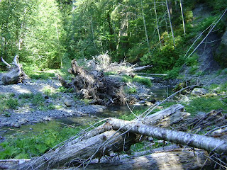
"Crazy" and I recon- noitered the area, upstream and downstream, and were able to get a good feeling of the possible track course, despite the amazingly thick alders and overgrown understory now covering the once nearly barren sand bar. (Time for another flood?) Problematic, however, is that an unobstructed view of the background trees is not fully possible, and several landslides on the north side have taken out many of the potential identifying older trees.
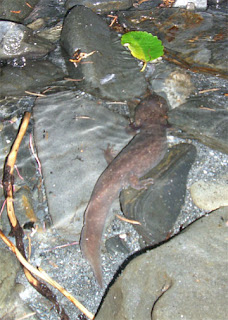
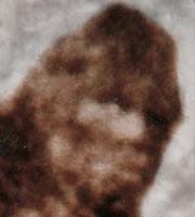
Having recently been privy to a report of a cryptid (mythical?) GIANT SALAMANDER seen by M.K. Davis while guided by Don Monroe, we tended to have our eyes out for such a thing. This sighting was in a pool in Bluff Creek right around where Notice Creek enters it, near Louse Camp. M.K. said it was around three feet long!
As we proceeded downstream in rubber boots, under and around tremendous knots of wood bracken, roots and trunks, we came to a small shore-side pool where something was seen. Looking closer it was about a foot long. It was a Giant Salamander, for sure. Having once caught a terrestrial Pacific Giant Salamander, I tried to grab this one; but it was amazingly fleet, and swam away rapidly like a fish. We obtained photographs, and noted small gill fans at the sides of its head.
Or... could it be just an infant state of the REAL BIG ONE that M.K. saw, and that has been told of in legend? Many believe these giant ones DO exist here, much as they do in Asia. For size reference that is a fairly large alder leaf above, and the creature is several inches deeper down in the water. [Image: "Crazy" Ian]
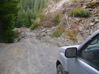
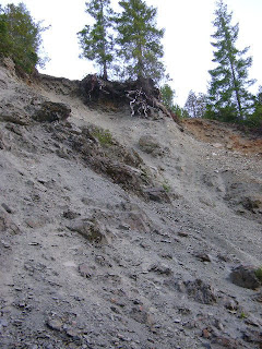
As the day waned we headed down 12N13 toward Louse Camp for the night. However, about 1/2 a mile up from the camp there is a HUGE LANDSLIDE. So, BE FOREWARNED, take the southern Onion Mountain route to Louse.
Just around the bend from the Notice Creek drainage, this slide has covered the entire road quite deeply, with the massive collapse going all the way up to the top of the ridge, including huge boulders and many trees. Given the current state of government we seriously doubt this damage will be corrected any time soon. It would require the reinforcement of the entire mountainside, not just a plowing--it is that thick. Only an ATV could make it over that hump. If you plan to camp there you will have to walk in--no easy car camping.
IMAGES: by Steve Streufert, June 2009, save where noted. The topo map below is from Ian's cool GPS unit, which got a good signal all along the way.
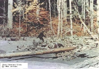
After a fine night at BEAN'S CAMP, just across from the 12N13/Cedar Camp junction and down the hill a bit, we headed back to get the car towed. Amazingly, there was a cell phone signal up at the top of the film site road! This enabled Buddy's Towing to come all the way up from Willow Creek to tow us out, over sixty miles each way, over dirt, gravel, river, hill and dale. It was a fine trip! But no Bigfoot sightings were made nor evidence found. In a way, we didn't NEED that! IMAGE: Patty cruising the Film Site, October 20th, 1967. From the publicity photo distributed originally by Roger Patterson with his book, "Abominable Snowmen of America: Do They Exist?"
If you are heading up to Bluff Creek, be sure to check with the Forest Service about road conditions. And ask the guy in the Willow Creek office to sell you a Klamath-Trinity/Six Rivers Forest Atlas, which he normally keeps hidden in his desk. He knows some great Bigfoot sighting stories, too.
Regarding the timeline: There seems to be no way P&G could have taken the rugged Bald Hills Road in the given time frame. We're with Perez on that one. Also, given that road conditions in 1967 were probably not as amenable as today, even the route through Willow Creek is problematic. It is a long drive. It is impossible to determine what their time would have been without knowing the state of the roads, the capabilities of Gimlin's truck, and not even knowing exactly which route they took to get down from the film site. These factors need to be determined. Could the roads have been BETTER in those days? Seems unlikely, save for the road going up to the filmsite from Louse Camp. On top of this, the post offices out here close at 5:00, so there is no way they could have used the Eureka USPS (assuming similar business hours, assuming Al Hodgson is right about the post office, and not the Murray Field airport being the sending site). They could have mailed it in Willow Creek, as some such as Long have suggested, but the mountain mail truck these days leaves here at 3:45. We assume a similar situation back then, but just can't be sure. The distances, too, are just too great, in our humble opinion. You can check this on Google Maps: just enter from "12N13" to Eureka, CA, the rough parameters of the trip. You'll get a result of: "102 mi – about 2 hours 43 mins." Or try this, for 12N12: http://maps.google.com/maps?f=d&source=s_d&saddr=For+Route+12N12,+CA+00049&daddr=Eureka,+CA&hl=en&geocode=&mra=ls&sll=41.10871,-123.895005&sspn=0.731548,1.487274&ie=UTF8&ll=41.097982,-123.895569&spn=0.731663,1.487274&z=10. How DID they do it, and get back shortly after Al Hodgson's 6:00 store closing time? WHY would they even need to fudge the timeline, if they did? There was no real urgency beyond excitement, and nothing (we assume) to hide. So, just as with the exact film site location, the timeline too has large factors of indeterminacy, even at times impossibility. What we are left with is an often conflicting bundle of stories and and later recountings, memories muddled (we all remember and see differently, and don't exactly record everything in daily life accurately for later reference) after 41 and a half years (no, I am not bunking Bob), and each book that comes out only seems to ADD further piles of inaccuracy to them! What do we know for sure, and what are we simply guessing at? Why do so many researchers differ in their conclusions about something so simple as taking a minute of footage and driving it to town? THIS needs to be analyzed. Without a clear timeline there will only be further compounding of errors, and this leaves room for debunkers to step in and call the whole damn thing a hoax. Where there are gaps in the information there is room for conspiracy theory, or dismissal.
(From the Vaults of Our Vast Blog/Research Backlog, Here Comes Another One)
The PGF site and track-way location often seem like a moving needle in a very
large haystack. (Paraphrased from a statement Sean Fries made about Bigfoot.)
If you can hide a film site in here, you can surely hide a Bigfoot!
This is
Part Two in our Preliminary Information Series
for the upcoming blogs on our recent
BLUFF CREEK FILM PROJECT.
Hello All! Here is some more highly enjoyable fodder for your Bigfoot Nerdiness. This blog entry is a collection of background research and inquiries we made in regard to the location of the Patterson-Gimlin Bigfoot film site, and the history of Bluff Creek. Little did we know that this issue would generate controversy and politics; but lo! it is already coming our way. Please also see the preliminary information entry, part one, our INFORMAL INTERVIEW WITH JIM McCLARIN. Soon all will be revealed when Robert Leiterman gets through with the massive job of editing over six hours of raw video. These will be presented on BFRO-VIDEOS, the BFRO YouTube page.... soon, we promise, soon! Robert is calling these The Bluff Creek Film Project: A Journey of Rediscovery. What will follow in future blogs and these videos is US trying to discover the real site, prove it if we can, and perhaps to rule out the false ones among at least FIVE variant proposed film site locations. It ain't easy, as we weren't there in those early days; and many who were either can't seem to exactly recall, or present varying views, or have noticed upon returning to the area that it has changed beyond recognition. Crucial early witnesses such as Bob Titmus and Rene Dahinden are sadly no longer with us. We, ourselves, have been to the PGF site about 10 times now, as part of many more general Bluff Creek trips, and feel it is time to express our provisional views and opinions. Just consider what follows from that perspective, and consider the evidence we present. If you have contrary views, do feel free to contact us.
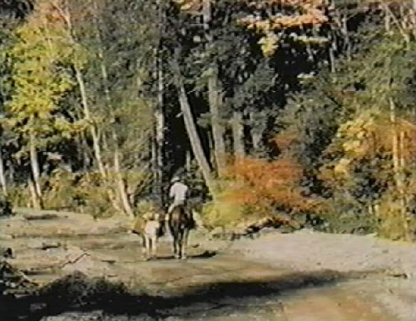
Bob Gimlin on the Bluff Creek "road," or, dirt and gravel trail. On the path
of Bigfooting destiny. Filmed by Roger Patterson.
Since we talked a lot with Mr. McClarin about the Bluff Creek creekside "road," really a logging plow, a cat trail, and then a Jeep path, here for your viewing pleasure is a decent image of BOB GIMLIN riding on that road. It is taken from the very same reel that later bears the PGF Bigfoot segment, and in fact, comes right before it on the reel (as seen in John Green's copy of the film, as shown on the BBC X-Creatures documentary), and was shot that same day, October 20th, 1967.
*********************************
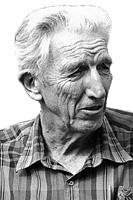
A gaze seemingly from another world.
How, you might ask, can a location as famous as this become "lost"? This is the Bigfooting equivalent of losing track of where JFK was shot or, in personal terms, losing track of the house where one lived as a child. In regard to research seeking to prove whether Bigfoot really does exist as a species, this location may not be so significant--and many indeed have questioned our obsession with this site and area. What does it really matter? To us, though, it does matter--on a primary level simply because we want to feel the magic of the place; but more pervasively it is an important part of verifying the background and context of this famous film. Though many consider the PGF to be a hoax, the fact remains that it is the most compelling and undeniably vivid pieces to the Sasquatch puzzle. It has yet to be replicated, and cannot seemingly be disproved. If this is not a film of a man in a suit, then what IS it? Clearly, it is the moving image of a living creature, one not yet verified by our presumptuous and conservative Science. Therefore, anything, any little piece we may know about this film and its production, and the PLACE where it was taken, is of incredible import to the world of wildlife biology and hominology. We urge you, therefore, to read on....
*********************************
The following conversations were conducted mainly via email, though in some cases are based upon personal conversations as well.
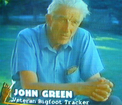
Green in the A-and-E Bigfoot: Ancient Mysteries documentary.
Photo taken from VHS on TV, by Steven Streufert.
A BRIEF TALK WITH JOHN GREEN
We consider John Green to be the "Moses of Bigfooting." His early books clearly did more to advance the subject than anything short of the PGF itself. He did this with logic and wit, taking the subject seriously rather than sensationalizing it. If it weren't for his involvement in the field and during Onion/Blue Creek Mountain track-way finds, and his contact with Roger Patterson, there most certainly would never have been a PGF. He was one of the first researchers on the scene documenting the film site, though ultimately fellow Candian, Rene Dahinden, was the one to document it most thoroughly over time. From what we can tell, John was on the film site with Jim McClarin in 1968, then sometime around 1998 to 2000 with Bob Titmus, and finally went there in 2003 with the attendees and speakers of the International Bigfoot Symposium. Sometime before the last date the site had changed so much that Green could no longer recognize it with surety. Rather than trying to be a big shot about it, he admits this, and we find that honorable and true to his character and integrity. Green was also an original member of the Pacific Northwest Expedition into Bluff Creek in 1959.
BIGFOOT BOOKS (OUR LETTER):
"Hello again John,
Might I ask you a few brief questions? A few associates and I are going back yet again this coming weekend to Bluff Creek, our goal being to record and document a trip from Louse Camp to where we all think the PG film was filmed.
Could you tell me:
* when you were last there did you feel certain that you were on the right spot?
* if so, what signs did you see that would confirm it?
* was it upstream from the flat at the bat boxes? Or downstream, as MK Davis thinks it is?
* how far up? At the big gulch with the logjam and rootballs, or perhaps a bit farther? If down, how far?
* did you find the "big tree"?
* how far from the current creek position is it, and how much is left of it in a level state as seen in the old days?
If I send you a close-up topo map could you put your X on it? I've already asked this question of Perez, Barackman, and a traveling companion of MK, as well as many of the California BFRO guys. Al Hodgson feels that the site visited in 2003 is incorrect. I feel that your perspective on these matters would be invaluable, especially as a new generation is moving in, and there are some wildly divergent opinions. Your reply before Friday would be greatly appreciated! Thanks!
Best regards, Steve, Bigfoot Books, Willow Creek"
JOHN GREEN:
"I am not certain that I was at the right spot, because I could not find the big tree. Otherwise I would have been sure, as I could only find one place where the level area in the bottom of the valley seemed sufficiently wide. If that is the right place then the creek has changed course from the one side to the other and eroded the entire site of the action away. Keep in mind that I was just there once, in 1968, and did not try to find it again for about 30 years."
BF BOOKS: Hi again John,
This kind of thing makes me worry we will never again be sure of the place. I mean, the exact location of the film trackway.
I wonder, do you have any other photos of the film site, aside from the more common ones that one sees on the internet? What one normally sees is the thing with Jim McClarin in it. Any others, especially those documenting the trees and surroundings, would be absolutely helpful to us. We'll be up there on the 18th of this month.
I've been asking around, though you are the one I'd trust the most without Rene around anymore. I sent a similar email to Peter Byrne, but I'm not too sure of his opinion after reading the Todd Neiss account where they quickly found the film site in only 15 minutes, and supposedly found the "big tree" that no one else has yet to locate with utter confidence.
After talking to Daniel Perez about this at length, I'm not too sure that his "X" on the map really corresponds with his location of the place on the ground. Do you recall, when you were there with him in 2003, did he actually settle on a single spot? And was that upstream from the "big gulch" where the creek splits into two streams at the logjam area? His "X" on the map is upstream from that area.
Green on Blue Creek Mountain, 1967
Any help you can provide would be greatly appreciated; and we would give you all the credit you deserve for it. I'll be writing about the trip on my blog, and Robert Leiterman is going to film it for presentation on the BFRO videos page on YouTube.
Thanks, and best regards, Steve, Bigfoot Books, Willow Creek
JOHN GREEN: "I have nothing further to contribute, and haven't even much recollection of the area as it was in 2003 {?}. I don't recall much about the location Dan picked out, except that it was in a wide area but there was no sign of the big tree there. If the tree had been logged there should be a stump, and if it fell down it should still be there and there should be a large hole, but nothing of either sort was found. Rene and Bob Titmus both knew how the site had been transformed through their repeated visits, but when I was down there with Bob about 10 years ago he was not able to hike in. He told us to walk the old road across the west hillside and we would be able to look down on the site, but we never saw anything recognizable and when we went down and walked back and forth along the creek we only found the one area where the level bottom of the valley was wide enough. In 1967 the creek was close to the east (?] side of the level area, but in the intervening years it had eroded its way close to the west side, so it must have washed away the actual site.
Jim McClarin or Al Hodgson might be able to help. [ED. NOTE: Excision of one sentence for reasons of privacy.] I still think the only reliable test is if someone can locate a place wide enough for what the film shows and with a big tree close by on the hillside. "
*********************************
Byrne in the A-and-E Bigfoot: Ancient Mysteries docu-
mentary. Photo from VHS on TV, by Steven Streufert.
A BRIEF CONVERSATION WITH PETER BYRNE
Peter Byrne first found a Yeti track in 1948, so he has been at this business for quiet a long time. He was involved in the Tom Slick-financed Abominable Snowman hunts of the mid-late fifties, eventually being brought over by Slick to take over the Pacific Northwest Expedition here in our Bluff Creek area. He has been one of Bigfooting's most public and recognizable figures, always presenting a striking and somewhat heroic image in his fedora, ascot tie and safari suits. He is known to have been at the PGF site in 1972, and then off and on over the years as he retired from and then re-entered the field. Even at his advanced age now, he visited the film site again just this year.
(This is fundamentally the same letter sent to Green. Below find Mr. Byrne's responses in CAPITALS.)
Hello again Peter,
Might I ask you a brief few questions? A few associates and I are going back yet again this coming weekend to Bluff Creek, our goal being to record and document a trip from Louse Camp to where we all think the PG film was filmed.
Could you tell me:
* when you were last there did you feel certain that you were on the right spot? Todd Neiss says so in his account.
* if so, what signs did you see that would confirm it? Are there photos?
PETER BYRNE: LAST THERE? LAST WEEK.
AND, SIGNS ... THE TREE GROUPINGS, ESPECIALLY ONE TREE THAT APPEARS IN THE FOOOTAGE, VERY LARGE AND OLD NOW (100 YEARS).
THERE ARE LOTS OF PHOTOS OF THIS PARTICUAR GROUP OF THREE TREES. ONE OF THE BEST IS FRAME 352 OF THE FOOTAGE.
* was it upstream from the car park flat at the bat boxes? Or downstream, as MK Davis thinks it is?
PETER BYRNE: NO. MK IS WRONG. THERE ARE TWO BAT BOXES, NOW BOTH DOWN. (VANDALS) FROM THE NORTHERN MOST OF THE TWO BOXES ONE CAN DRAW A LINE DUE (NOTE, MAGNETIC) NORTH DIRECT (ACROSS THE STERAM) TO THE LARGEST OF THE TREES. DISTANCE? ABT 100 YARDS.
* how far up? At the big gulch with the logjam and rootballs, or perhaps a bit farther? If down, how far?
* did you find the "big tree"?
PETER BYRNE: THE SAND BAR ON WHICH THE 67 FOOTAGE SUBJECT WALKS IS GONE NOW AND HAS BEEN REPLACED BY THE STREAM ITSELF. SO WHERE THE STREAM IS NOW, THAT IS WHERE THE SAND BAR WAS. THE SAND BAR YOU WILL RECALL EDGED THE HILL, IN THIS CASE THE HILL THAT RISES ON THE WEST SIDE OF THE STREAM. BUT NOTE, IN ELIMINATING THE SAND BAR (WASHING IT AWAY WITH FLOODING ETC) THE STREAM HAS NOW DUG ITSELF A 20 FOOT DEEP BED. SO THE ORIGINAL LEVEL OF THE SAND BAR, WERE IT THERE NOW, WOULD BE 20 FEET ABOVE THE WATER OF THE STREAM OR, NOW, THE SAME LEVEL ON WHICH THE BAT BOXES LIE. AGAIN, NOTE, THIS MEANS THAT THE BIG TREE AND ITS COMPANION GROUP (OF TWO) WHICH ORIGINALLY APPEARED IN THE FOOTAGE AS GROWING OUT OF THE SURFACE OF THE SAND BAR, NOW HAVE ROOT SYSTEMS 20 FEET HIGHER THAN PREVIOUSLY. ALSO FOR YOUR INTEREST SOME OF THE STUMPS (TWO ANYWAY) WHICH APPEAR IN FAME 352 ARE STILL THERE (AS OF LAST WEEK).
* how far from the current creek position is it, and how much is left of it in a level state as seen in the old days?
PETER BYRNE: IS WHAT? THE TREE? SEE ABOVE.
Also, how did you access the site in the old days?
PETER BYRNE: NEVER DID. THERE WAS NO "SITE" IN MY DAYS THERE ... 1960 THROUGH 1962, YEARS BEFORE THE FILMING. I HAVE BEEN TO THE SITE SINCE THEN MANY TIMES, FOR RESEARCH, PHOTOGRAPHY, MEASUREMENTS USING AMONG OTHER THINGS AL HODGSON'S SON RICK AS A MODEL.
If I send you a close-up topo map could you put your X on it?
PETER BYRNE: I'LL TRY. BUT ITS NOT HARD TO FIND THE SITE. ROAD 12N10H (VIA 12N10 FROM ORLEANS) [Ed. Note: Actually, it's 12N13, and 12N13H, off "Eyesee Road," the G-O Road, from Orleans.] GOES RIGHT TO IT...AND IS 4 x 4 DRIVEABLE. THE OTHER WAY IS TO GO TO LOUSE CAMP (WHICH I AM SURE YOU CAN FIND) AND WALK UP THE STREAM UNTIL YOU COME TO A LARGE (40 FEET + HIGH) ROCK OUTCROP ON THE EAST SIDE OF THE GORGE. THE SITE IS ABOUT 350 YARDS BEYOND THAT.
I've already asked this question of Perez, Barackman, and a traveling companion of MK, as well as many of the California BFRO guys. Al Hodgson feels that the site visited in 2003 is incorrect. Many area locals around here all seem to offer different locations, too. I fear that the site may soon be "lost" to posterity if we do not act. I feel that your perspective on these matters would be invaluable, especially as a new generation is moving in, and there are some wildly divergent opinions. Your reply before Friday would be greatly appreciated! Thanks!
The famous Peter Byrne Photo, Al Hodgson's Print,
given to him by Peter Byrne as a gift (it features Al's son);
photographed at Al's home, 2010, by Steven Streufert.
PETER BYRNE: I'LL ATTACH A PHOTO OF THE SITE WHICH I THINK (TOO SMALL TO SEE IT IN MY FILE) IS FROM ONE OF MY VISITS IN 1972, WHEN THE SITE WAS STILL INTACT OTHER THAN LOSING THE BIRCH TREES [Ed.: Alders and Maples, actually] SEEN IN 352.
BIGFOOT BOOKS: Peter, I'm thinking about this more, and wonder:
Your location of the site across from the bat boxes implies that if you are standing at the parking area there looking north, right by the fire ring and all, the creek would probably have been flowing where you parked your truck, more or less, in order for there to be sufficient space for the sandbar and the dimensions of the film. Is that correct?
PETER BYRNE: THE ANSWER TO THIS LIES IN THE WIDTH OF THE ORIGINAL SANDBAR. THIS MAY HAVE BEEN RECORDED SOMEWHERE; I DO NOT KNOW WHAT IT IS. OR WAS. SO... TO TRY AND DETERMINE WHERE THE CREEK WAS IN OCTOBER 1967 JUST TAKE THAT MEASUREMENT, WHATEVER IT IS, AND MEASURE OUT FROM THE BASE OF THE HILL. THAT WILL GIVE YOU THE SANDBAR'S ORIGINAL LOCALTION.
The "big bend" of which Gimlin speaks would have been downstream from the camping area, and the retreat of Patty (after Titmus) would have been near that tiny creek that flows into that "big gulch" there today, which is where Murphy locates the site. Right?
PETER BYRNE: YES BECAUSE GENERALLY SPEAKING THE OLD COURSE OF THE STREAM HAS NOT CHANGED; THE BENDS, UP AND DOWN, NORTH AND SOUTH, ARE STILL THE SAME AS IN 1967.
I'm wondering if 20 feet of erosion is possible, too. Down in the gulch there seems to be some six feet of descent of the creek from the old sand on the bar, which is easily recoverable by digging one's hand down at the roots of the alder trees in there.
PETER BYRNE: LET ME ASK MY COMPANIONS OF LAST WEEK WHAT THEY THINK THE NEW DEPTH OF THE CREEK IS. I DID NOT MEASRE IT. IT MAY HAVE BEEN A BIT LESS THAN MY ROUGH EYE MEASUREMENT OF 20 FEET.
Anyway, we will definitely be checking your location. Any further tips would be of great help, especially a recent photo of the big trees.
PETER BYRNE: THE BIG TREES ARE NOW HEAVILY OBSCURED BY BRUSH AND HARD TO PHOTOGRAPH AT THIS TIME. HOWEVER, THE SINGLE BIG TREE (SEE FRAME 352) IS DISTINGUISED BY FOUR THINGS. ONE, ITS OBVIOUS AGE. TWO, ITS GREAT SIZE. THREE, ITS BARK WHICH IS HEAVILY INDENTED BY WOODPECKER HOLES. AND FOUR, ITS COMPANION TREES, AS SEEN IN THE 67 FOOTAGE AND AS SEEN IN MY PHOTOGRAPHS TAKEN IN 1972 (I'LL TRY AND FIND ONE AND ATTACH IT HERE). ALSO, AS OF NOW, ITS POSITIVE DIRECTION FROM THE UPPERMOST (THE NORTHERN MOST) OF THE FALLEN BAT BOXES WHICH IS CLOSE TO (MAYBE FOUR DEGREES LESS) MAGNETIC NORTH. USE A GOOD COMPASS, STAND CLOSE TO THE EAST BANK OF THE STREAM WITH YOUR BACK TO THE UPPERMOST (NORTHERN MOST) OF THE FALLEN BAT BOXES AND TAKE A BEARING; YOU SHOULD HAVE NO TROUBLE FINDING IT.
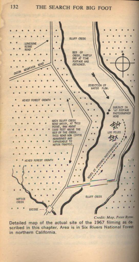
The old map from Byrne's book,
strangely out of correspondence
with any known landscape features.
Or, was Peter keeping the location
secret? And where is/was that bridge?
Click to Enlarge.
I asked these same questions of John Green, but he could not say at all for sure, and did not get a clear sense of where the site was when they were all there with Bob after the 2003 symposium in Willow Creek. Bob was not positive either. Daniel seemed to know, but where he was differs from the mark on the map of Dahinden. None could identify the big tree. Hence, you seem to be the only one with a positive identification, save for newcomers who were not there in the days you guys were.
PETER BYRNE: GOOD LUCK. LET ME KNOW HOW YOU DO, PB.
PS/ CANNOT IMMEDIATELY FIND THE PIX I WANT TO SEND YOU. WILL SEARCH LATER TODAY AND SEND. IT IS ONE FROM '72 THAT HAS ALL THREE TREEES IN IT.
*******
PETER BYRNE: THIS PIC (1972) SHOWS THE BIG TREE PROBABLY BEST. NOTE ITS COMPANION TREES, STILL STANDING TODAY.
STEVEN ONE LAST NOTE...
IN MY NOTES TO YOU ... MY ESTIMATION OF THE DEPTH OF THE STREAM (ITS CHANNEL DEPTH, NOT ITS WATER DEPTH) FROM THE LEVEL OF WHAT USED TO BE THE SURFACE OF THE SAND BAR, IS VISUAL ONLY; WE DID NOT MEASURE IT. NOW MY ASSOCIATES IN CONSULTATION TELL ME THAT IT IS PROBABLY LESS THAN 20 FEET; MORE LIKE 10 OR 12 FEET. OVER TO YOU. PB
*********************************
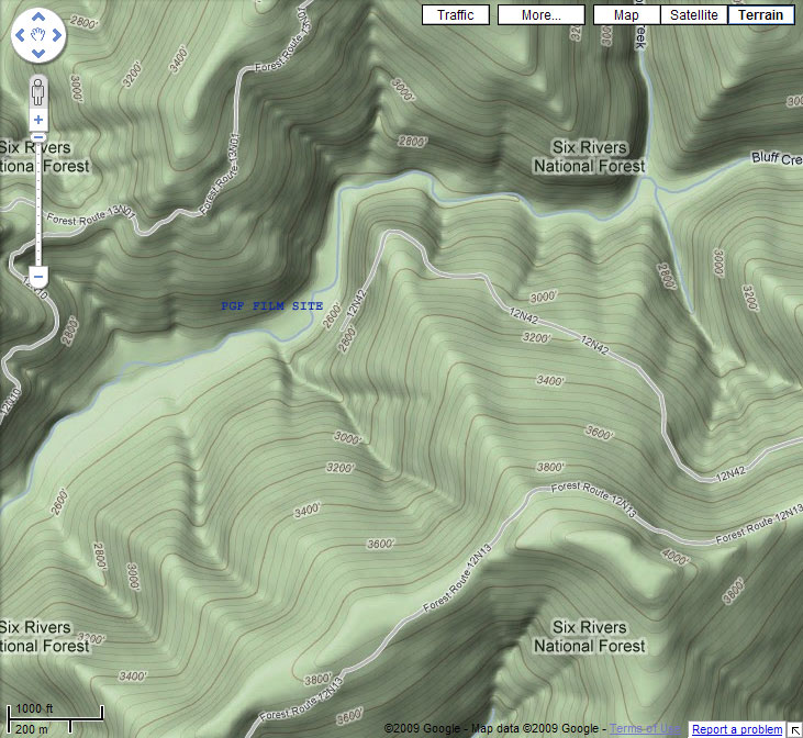
OUR SUMMARY OF P-G FILM SITE LOCATION THEORIES:
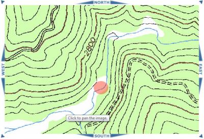
The Heart of Bluff Creek, and Lonesome Ridge
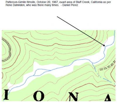
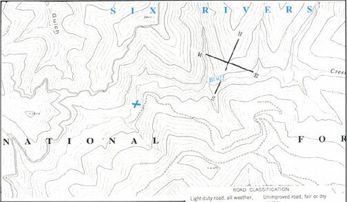
Here are two maps of the upper Bluff Creek basin, the confines of which are known to be the area where the famous PGF was shot in 1967. However, there is much dispute as to the EXACT location. The first map is a wide view, just up from Louse Camp. The second map, not to wholly bias the answers, shows the more precise area where most believe the location is.
PGF General Consensus Site Area, Detail, MK to Barackman
In studying this so far we have found the following.
* MK Davis feels the site is 500 yards or so downstream from the "bat boxes" at the landing below the dirt road seen in map 2.
* Peter Byrne says it is is right across the creek from the nearest bat box at the bottom of the road.
* Christopher Murphy thinks the site is right at the bottom of the "big gulch" bend seen in Map 2, just east of the little creek.
* Daniel Perez was seen identifying the site and investigating just up from Murphy's location.
* Perez' BIGFOOT AT BLUFF CREEK places the site, according to Dahinden, upstream just a bit, on the second segment of sand bar, just below the "bowling alley" (where the creek juts directly north).
* Cliff Barackman (and ourselves, sometimes) believe the last choice to be correct. Associates and I are currently investigating this and documenting topography, dimensions, extant background trees, etc.
* Others, such as some locals like Al Hodgson, think it was shot WAY downstream, more towards Louse Camp. None seem to agree on this locally.
* A few speculate that it was shot up at the top of the "bowling alley," or perhaps even so far upstream and to the east as Scorpion Creek (off the maps provided here).
Weigh in: take the images and in your favorite image processing program put an "X" or arrow to the spot you favor. Any supporting reasons or evidence, text or photos, as to why you believe such would be greatly helpful to all. Note: the "bat boxes" are just to the other side of the small creek entering the gulch, past to the west where the road is shown ending on the map above. The road actually goes down past that little creek a few dozen yards, as drawn in below.
As a Preview to Upcoming Blog Entries, Here is a Sketch of
Our Preliminary Findings of the Various Site Location Theories,
with a few common landmarks. Do CLICK TO ENLARGE VIEW.
*********************************
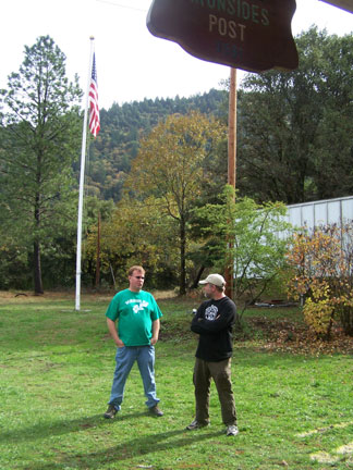
TALKING WITH SEAN FRIES
Sean with Cliff Barackman, 2007 PGF 40th Anni-
versay Celebration. Photo by Steven Streufert.
We talked with SEAN FRIES, Bigfoot researcher from Weaverville, CA, and he told us the location of the "M.K. Davis" Film Site, with which he agreed. Sean has spent many, many days in the area around Bluff Creek and in the mountains of Trinity County around his hometown. He has maintained a somewhat independent status as a researcher, though he was for a time affiliated with NABS. He told us that he has basically retired from the field of late, after having had a close-up face to face sighting of the Creature in Question. It looked more Neanderthalian than ape-like, he told us. Sean's writing may be found as included in Who's Watching You, by Linda Coil Suchy.
Sean had been there with M.K. Davis on a hike all the way up Bluff Creek a few years earlier. The came to this spot downstream from the area most feel is the PGF site and felt it to be right, going against the general consensus of most other researchers. It is, according to Sean, 500 yards downstream from the bat boxes camp site landing, at the bottom of 12N13H. (This site has been located and confirmed by us--see our future blog entries, and in map, above.) We had this little exchange, among many others, with Sean....
SEAN FRIES: I still haven't placed it yet [the commemorative bronze plaque to be placed on the spot M.K. thinks is the correct film site], Steven but will soon. The BFRO site is BS--just look at how steep the canyon walls are there, its way too steep.
BIGFOOT BOOKS: Sean, perhaps you'd like to go up there sometime? I'd just like to get your perspective on the site. I'm planning at least two Bluff trips this summer, with other BF people you would surely get along with (unaffiliated, I mean).
It's not just BFRO that says it's upstream, but also Mr. Perez, on the word of Dahinden. And Barackman, now non-BFRO. Pretty darn convincing, no?
The associate I'm going up there with first, in fact, fairly firmly suspects that the site is downstream, as you do. So, that would be a very interesting and productive trip.
SEAN FRIES: Sure, I would be willing to go up there with you.
[Ed.--That trip hasn't happened yet. It would be nice, though, to truly verify the site and come to a collective agreement as a research community before any "official" plaque is installed.]
*********************************
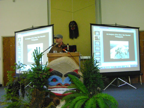
TALKING WITH CLIFF BARACKMAN
Cliff Barackman presenting at the 2010 Oregon Sasquatch
Symposium. Photo by Steven Streufert
Last summer, 2009, we sought to clarify the location of the site and exact trackway, as we'd been going up there for a couple of years without any absolute certainty. In the course of this inquiry we talked with many researchers. Perhaps most helpful was CLIFF BARACKMAN, out of Portland, OR. Cliff provided this witty little synopsis for us by way of a professional biography:
"I'm entering my 17th year of field work. I've bigfooted in more than a dozen states and provinces. I've recorded this and that. I'm trying really hard to film one. I have a website and blog. I've been a guest speaker here and there. I've done some media appearances. You know, that sort of stuff."
Enough said, perhaps; but we consider him one of the very best field researchers in the world. He loves to be outdoors and so, he says, he does it for the FUN. A good attitude to have when looking for the Bigfoot in a haystack. Here is the exchange we had with him, along with the mark he made on the topo map we sent him.
BIGFOOT BOOKS: Howdy Cliff (and Daniel),
I'm working on a little project trying to compare the exact locations various BFers claim as the actual PGF site. I figured I'd ask you two first. Personally, I feel I've been on the very spot Patty stood, but I find it a bit disturbing that I can't prove it.
I've looked around on BFF, for instance, and found that people believe all kinds of weird locations are the spot. When GPS coordinates are given they are nearly always different. Perhaps, if you have a photo editing software program, could you mark an "X" or draw a trackway on the most precise spot you think is accurate? It took me about two minutes in Photoshop to do my own version.
Also, if you know the locations of these I'd really be happy to know:
* Jerry Crew's footprint find, the famous one
* John Green and Dahinden's Bluff Creek sandbar prints
* Onion Mountain and BCM trackways
* MK Davis' supposed "downstream" film site location
I want to see a map of the entire Bluff Creek watershed with accurate BF sites located. This, when done, would be available freely to all in the BF community, and I think would clear up a lot of silly controversies.
Thanks so much, whatever you can do!
Best, Steve, Bigfoot Books
CLIFF BARACKMAN: Hey there.
The pic with Wally, Derek, and I was taken at about the middle of the east/west section right before the "bowling alley" turn. It is facing north. The pic of the thick stuff was somewhere in the middle of the path of Patty. Good to hear from you. Cliff
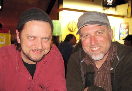
Yours Truly and Cliff, after a couple of beers, after the OSS.
Photo taken by "C.I."
[Ed.--to view Cliff's North American Bigfoot Blog entries on his trips to the PGF site and Bluff Creek use these links:
BIGFOOT BOOKS: [Speaking of our previous blog on the National Geographic filming crew landing on the PGF site area] Well, the helicopter had landed just past the log-jam area at the big bend just upstream from the bat box area and the alder forest next to it. On the gravel there they had markers for the GPS localities they thought were the film site. One by the helicopter on the north bank, and then another upstream a few hundred yards up, before getting to the spot you're describing. They thought that where THEY were was the actual film site. But where you guys are is a bit upstream from there, right? In your opinion or based on your information, where did Patty START walking? Does she finish walking right before the "alley" spot?
Up across the creek from where you guys are in the picture is a fairly high bank (going north), as I recall, with some fairly thick foresty stuff in there on what feels like old river bar ground, high sand and gravel content up there. If I am correct about your location I walked around up in there last year, and got a very good "read" of the location as pretty similar to what one can recall in there of the film.
Downstream the forest is mostly alders, but up where you are, up on the raised area from the creek, there were more firs, I found. I guess the downstream part could be the very start of the film, up where you guys are in the pictures the end. But what if it all took place back away from where the creek bed is now? I got that feeling when I was up in there. In the film Patty is really pretty close to the canyon wall to the north.
And why is this even controversial? It's strange. The ground itself has moved, and the trees in the film are apparently all gone or so changed as to be unrecognizable.
Keep up the good work, on the hunt and on your blog & web site!
Best, Steve
CLIFF BARACKMAN: Hey there. We were upstream from the spot the helicopter landed. I believe, though I could be wrong, that the spot the helicopter landed is thought to be the filmsite by Chris Murphy and a few others. My info comes second-hand from Dahinden through Perez. Dan showed me the map that Rene drew on pinpointing the location. This was seconded by Bob Gimlin when he went there with Bobo.
Others, such as Byrne and MK Davis have gone to the site in recent years and thought the location was downstream from the bat boxes, but this is based on what the creekbed looks like today, not then. As you noted, it has changed dramatically. Thanks on the kudos for my blog. It's fun. I like yours too. Cliff
Ed. -- and in a separate reply...
Cliff's mark on the map, just right of the Dahinden bump.
CLIFF BARACKMAN: Hi Steve, Good to hear from you. I'll help you however I can, of course. John Green might be of more help on most of the spots you'd like to pinpoint. I'm pretty sure I can show your the PG site and give you an indication where MK Davis' erroneous location is.
I sent back one of the maps you sent along. I added the red dot where I believe the PG site is.
Though I've been there and could tell you if we were walking there, it's hard to pinpoint MK's spot on that other map you sent because I don't remember the creek splitting like it shows. It's right about that spot, though. If I remember correctly, MK went there with Don Young, D-man [name edited for privacy], and Sean Fries. You probably know Sean since he lives in Weaverville [Ed.: excision]. He's gotta stop by your shop every once in a while. [Ed.: He does, indeed.]
I know this wasn't much help, but at least it's something. Let me know if I can be of any more help to you.
Take care, Cliff.
*********************************
THE DANIEL PEREZ INFORMATION
Daniel Perez speaking at the 2007 PGF 40th Anniversary
Celebration, Willow Creek. Photo by Steven Streufert.
We have talked quite extensively with Mr. DANIEL PEREZ about this. He is definitely our favorite journalistic historian of Bigfoot/Sasquatch. Read our interview with him, linked on the upper left side of this blog. We have to say, his work is absolutely fundamental. He's been into the subject since the age of 10, and began studying it seriously when still in his teens. While we were sending off for autographs to baseball players, Perez was corresponding with all the big-name Bigfoot researchers. Hence, he bridges the gap between the early 1960s and 1970s research and the current day, via his contact and friendship with Rene Dahinden among many others.
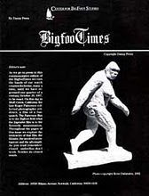
His booklet, BIGFOOTIMES: BIGFOOT AT BLUFF CREEK is absolutely indispensible. Everyone must have it (and we have them for sale at Bigfoot Books!). We first found the general site area based upon his booklet (with some help from Bobo and Tom Yamarone), bearing the mark on the map that Rene made. Hence, the general location was without doubt preserved, thanks to the perspicacity and tenacity of Perez. Still, when first standing with Scott McClean on the very spot where it was supposed to have happened, we both still felt rather lost. We just could not see anything at all familiar in that first glance, save that it was a wild place with a winding creek in a big mountain canyon.
The location in what we are calling the General Consensus Area (see map above) ranges up and downstream a bit when we try to locate the actual track-way taken by the creature in the film. In the images below one may see that the location varies a little in presentation; and then, there are the accounts that emerged from the 2003 International Bigfoot Symposium trip up there, stating that Perez was downstream farther than the mark, indicating that the site was there rather than up at the exact marked point. Many there agreed, others disagreed. Some such as Al Hodgson felt the location was not at all correct; others felt it was off just because no familiar landmarks were readily apparent. Some simply thought it was a touch up or downstream from where the Symposium group had gathered. Later, Bob Gimlin himself, when up there with James Bobo Fay, put his seal of approval on the upper sandbar location.
PGF BIBLE, no doubt.
We asked Daniel about this, trying to clarify whether Dahinden meant the "X" or arrow on the map to indicate the beginning, middle, or end of the track-way. We also asked him about the information provided by Peter Byrne, as above. Here's the relevant exchange:
BIGFOOT BOOKS: I'd appreciate your perspective, truly. Also, I really wish we could clarify exactly what Rene meant by the mark: the start the middle or the finish of the film trackway? On the ground these things are very important, whereas on a map it looks good enough for government work. I do not dispute the general location but rather seek the EXACT trackway path. Thing is, the X of Dahinden has to be more at the end segment, not frame 352.
DANIEL PEREZ: "Never got clarification w/ re to this from Rene. As for Peter, he is old and probably out a bit on his geography of the filmsite. dp"
Hence, though Daniel gets the location of the site correctly, the direction of Dahinden was not absolutely specific about the disposition of the course of the film subject. This is CONFIRMATION THAT DANIEL DID NOT GET THE EXACT LOCATION OF THE TRACK-WAY FROM DAHINDEN. However, they did not have commonly available GPS units in those days, and perhaps Rene felt that the mark was good enough, not knowing that there would be so much overgrowth and change in the area, leaving the location of the trackway ambiguous. Back in the days of Green, Titmus, Rene and the others, all one had to do was go there, and the site would be obvious when seeing the gravel/sand bar and the big tree in back. Now that stuff is obscured or altered. And opinions have in recent times begun to diverge. We hope to clarify all of this, so do keep up with our upcoming posts and the videos.
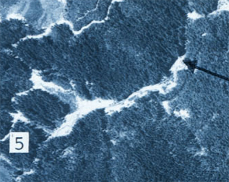
One last mystery remains for today. The above image is the most recent one from Daniel Perez, which he provided to us when we asked for an exact point at which Dahinden had place his mark. Note, in observing the image below, that the arrows in the two images point to two slightly different places along the creek. What is going on here? Is the site slowly moving downstream?
From Bigfoot at Bluff Creek: the arrow pointing to the UPPER sandbar.
Aerial image from 1973. USGS, as with the map below.
Another map from the Perez booklet, showing magnetic north on the compass.
The site? Also the upper sandbar. CLICK IMAGES TO ENLARGE VIEW.
Here's one more oddity: A Google Earth image found on Bigfoot Encounters, showing the "film site" downstream near the bat boxes landing. Clearly, the site is flowing downstream with the passing years!
And here, view M.K. Davis and crew on their version of the PGF site. We're not sure what the logging cable means, but we've asked MK about it. Yes, that is M.K. behind the video camera...
What me say, hu-man? You talk so much, hu-mans, me not want to hear another word! Me go now and grunt and howl. It more honest. It more true. Plus, it bring me Bigfoot mate.
**************************************************** This blog is copyright and all that jazz, save for occasional small elements borrowed for "research" and information or satirical purposes only, 2010, Bigfoot Books and Steven Streufert. Borrowings will be tolerated for non-commercial research purposes without the revenge of Angry Bigfoot, if notification, credit, citation and a kindly web-link are given, preferably after contacting us and saying, Hello, like a normal person would before taking a cup of salt. No serious rip-offs of our material for vulgar commercial gain will be tolerated without major BF stomping action coming down on you, hu-man.

 There is not too much to buy in there right now, but the Museum does have an ONLINE STORE. Click the link. One thing we can highly recommend for kids and adults is Michael Rugg's BIGFOOT DISCOVERY COLORING AND ACTIVITY BOOK, available in the store. It's not only fun, but also educational. They have a great selection in their BIGFOOT T-SHIRT SHOP via CafePress. This is one of the easiest ways to help, sure to be popular with your entire Squatching familia. The shop also features mugs, posters, calendars, stationery, a wall clock, a teddy bear, fridge magnets, mouse pads and a journal book. The prices are a little high, but you can consider it a charitous purchase.
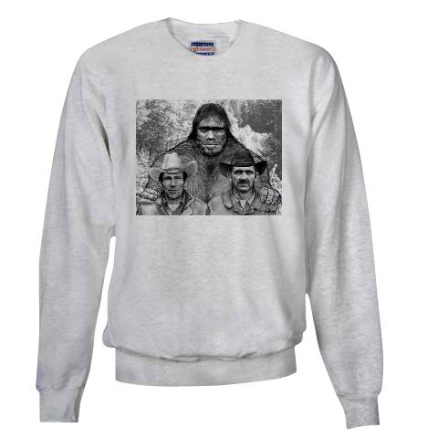


 Audio recorders
 ANGRY BIGFOOT SPEAKS!
 Just around the bend from the Notice Creek drainage, this slide has covered the entire road quite deeply, with the massive collapse going all the way up to the top of the ridge, including huge boulders and many trees. Given the current state of government we seriously doubt this damage will be corrected any time soon. It would require the reinforcement of the entire mountainside, not just a plowing--it is that thick. Only an ATV could make it over that hump. If you plan to camp there you will have to walk in--no easy car camping.
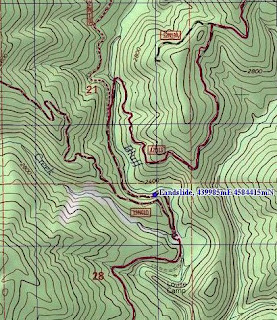


