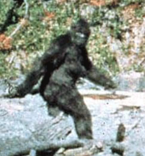
Mid-August always brings the call of the Bluff Creek basin and perfect weather and conditions for the exploration of Bigfooting history. The famous Onion Mountain and Blue Creek Mountain footprint trackway finds, investigated by Rene Dahinden and John Green, occurred at this time of year in 1967. This is the season that made Bluff Creek famous, leading up to the October 20th date when the Patterson-Gimlin Film was shot, and when the weather typically sours enough to bring snow and mudslides to the upper watershed roads.
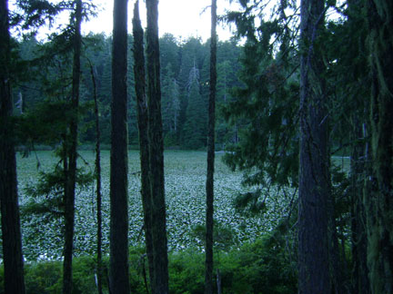
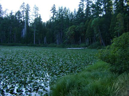
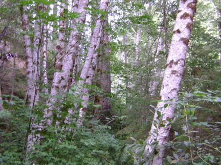
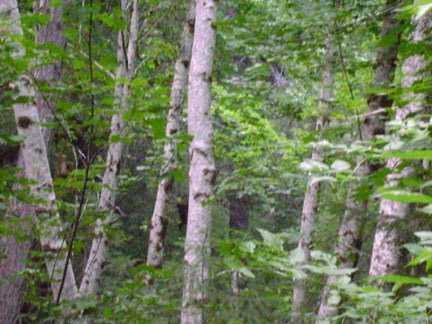
 Images: All shots (excluding maps) taken by Steven Streufert, 2009 (top three) and 2010 (the rest). CLICK TO ENLARGE, especially the MAPS.
FROM HIGHWAY 96 TO THE PGF SITE,
Bluff Creek Trip, Part One
 So it was that for three days our associate, "C.I." and ourselves ventured up Highway 96 from Willow Creek and up past Weitchpec to explore our favorite historical issues and locales, and maybe have an encounter with the Big Hairy Dudes ourselves. Here is Part One of our annotated pictorial presentation, complete with topo maps that may help you fine readers find some of these spots. Note--some aspects of this trip have been kept secret to protect current on-going investigations by other researchers of Bigfoot activity in the area. We will not disclose details at this time. Read on...
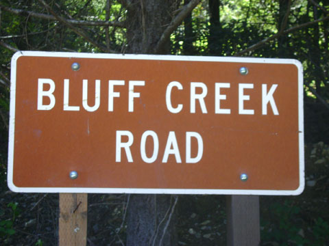
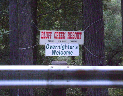
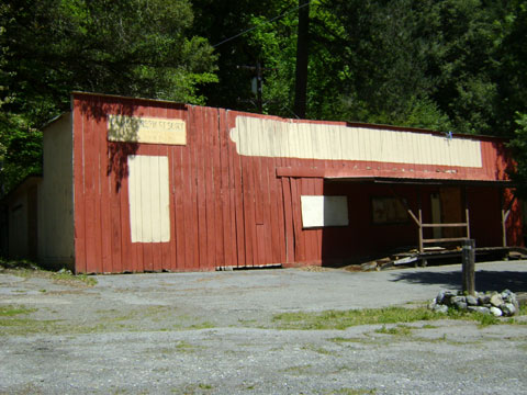
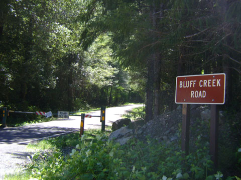
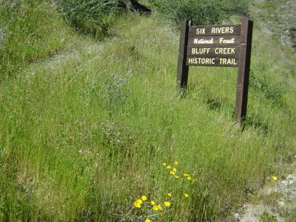
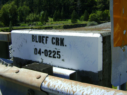
 Just past Weitchpec, where one crosses the bridge over the Klamath River at its confluence with the Trinity River, one takes a right heading northward on Highway 96, the official scenic "Bigfoot Byway." One passes the historic Bluff Creek Company store, now known as Bluff Creek Resort, just south a few dozen yards from the southern end of Bluff Creek Road. Just ahead, staying on the 96, is the bridge over Bluff Creek where it meets with the Klamath (and a sweet river access spot). On this particular trip we proceeded just a touch less than a mile farther north to a left on Slate Creek Road, officially identified as Forest Road 11N05.
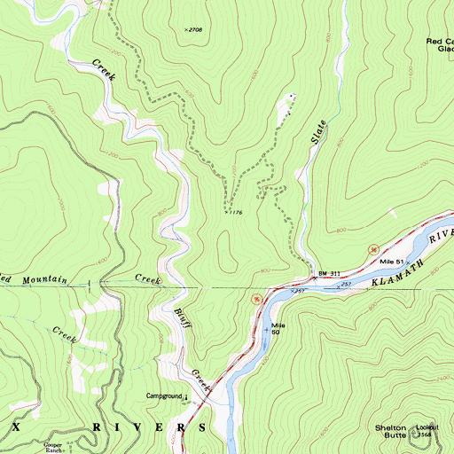
[At this point the traveler will dearly be wishing they had asked for and purchased the Six Rivers National Forest Atlas at the Lower Trinity Ranger Station just outside of Willow Creek. This book is worth every over-priced penny. Ask for it at the desk, where he keeps them hidden for some reason. Do note, the roads on the topo maps in this presentation are not quite as they appear in the Atlas and on the ground today.]

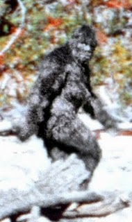
Was it a Bigfoot???
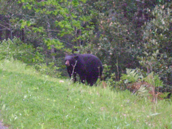
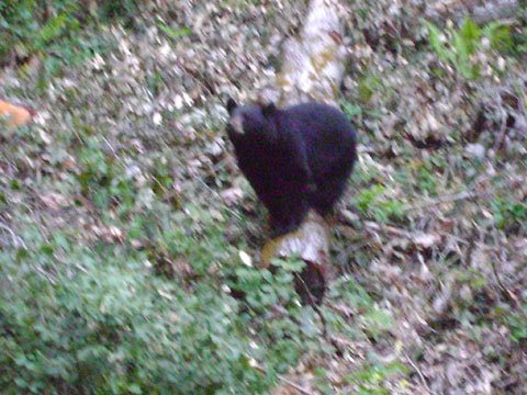
It was creeping around mysteriously, its visible parts appearing and then being obscured, much like one often sees in thermal night shots claimed to be of Sasquatch. Just as the suspense had risen to quite a high degree the creature's head rose up---and we saw its puffy, round ears. It was a black bear, apparently not smelling nor hearing us, ambling along right toward the edge of our camp. After a few moments we decided we'd better spotlight it, especially as our traveling partner did not have his second night vision scope unpacked at that time and could not see it in the darkness. The thing bolted rather quickly at the sudden change in lumens. This was to be one of three bear sightings on this three-day trip.
During the night we heard something that kind of sounded like a wood knock and then a smashing wood break, as if a limb had broken off a tree (at totally normal, non-Bigfoot-related occurrence). Later, way off in the distance, we heard some kind of vocalization, a barking sound that, however incongruous way out here in the middle of nowhere (we only saw three other vehicles up there the whole weekend), we'd have to ascribe to a dog rather than a Bigfoot. But who knows, eh? Twin Lakes are, after all, just a couple of miles directly east of Big Foot Creek, which flows into Bluff Creek at that point.
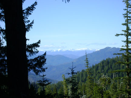
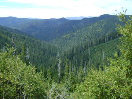 From our camp at the lakes we headed back out the next day toward Cedar Camp, up onto the ridge, heading toward Road 12N12. We stopped and found some cell phone reception up there (believe it or not!), while looking down at the fine westward view toward Bluff Creek, looking down the Fish Creek canyon. Somehow we drove right past Cedar Camp, which is apparently unmarked; but we did see a lot of lovely cedar trees. Up here they seem unaffected by the root rot fungus that plagues the Port Orford Cedar down at Fish Lake and Blue Lake on the south end of the Bluff Creek Road.
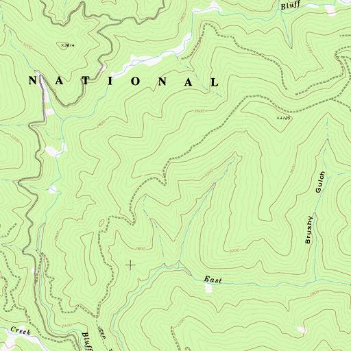
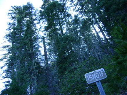
 One cruises along on 12N12 and without realizing it the green metal gate to 12N13, the left turn onto the "Sasquatch Road" according to local old-timers, suddenly sneaks up on one. Watch for it, or you will end up on the G-O Road (F.R. 15N01) and miss the turnoff to the PGF site. Any Bigfooter worth their salt, and with a decent high-clearance vehicle, will want to head down to the creek to set foot on that sacred and historical Bigfooting ground.
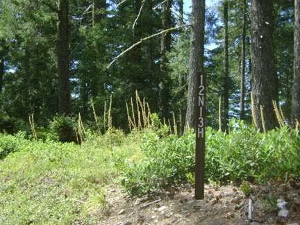
 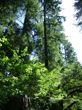 About three miles from the gate you will pass three vague old road spurs to the right. When you see a steep one on your left you're almost there. Soon you will come to a wide, flat pull-out log landing area, and to your right you'll see the 12N13H spur. You will see a small road marker sign at the entrance. Keep to your right once on the road. THIS is the road down to the film site, which is 2.1 miles down a rather steep course. Beware the treacherous rock slide down at the bottom, and be sure to keep your wheels UP on the slide's side, lest you slip off the edge and plummet down the near vertical drop through the woods to an untimely death on the film site below.
 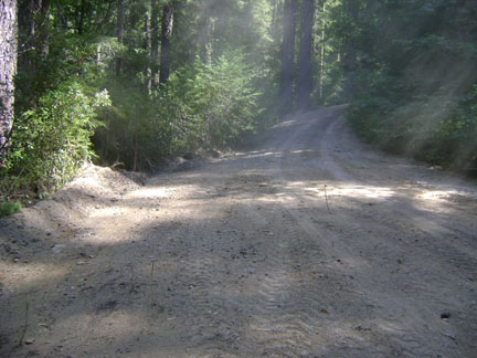 One thing that we found utterly astonishing, once on the familiar roads after Cedar Camp Road, was that all of these roads have been RECENTLY RE-GRADED. It is amazing to see the formerly hellish, shrubbery covered, pot-holed and rocky, tree-branch covered tunnel of the film site spur graded FLAT and clean, and fairly widely at that. It was that way all the way down to the big rock slide at the bottom. Those who have been to the site before will recall that it was essentially impossible to navigate this road without scratching the hell out of one's vehicle's paint job. All of those trees and bushes have been cleared away off the road. It is now like a Disneyland ride cruise down to the once nearly inaccessible site
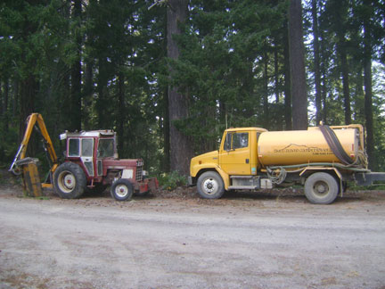 Now we understood the purpose of the construction vehicles we'd seen up at the top on 12N13. Don't let it fool you, though. One should still use a 4WD vehicle to traverse the last part with its rain gulches and all. At this point, before the rock slide, there are a few turnouts that can now be used to pull off and safely park your low-clearance car, and then walk the last little bit to the bottom.
 We, of course, drove on through, and we survived it. Down at the bottom one finds a flat landing area where one can park, and a fire-ring and primitive camping area. When we arrived here, like everywhere else on this trip, no one else was there. Very strange.
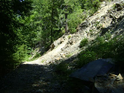
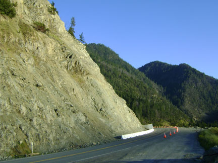
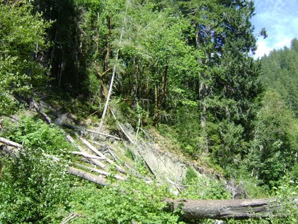
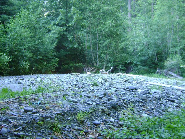
Here's a photo of the nasty rock slide at the bottom of the road to the P-G site. WATCH OUT! Many have nearly gone the way of Roger Patterson on this spot.
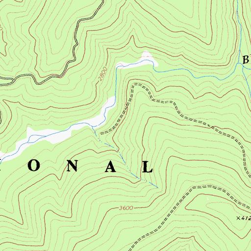
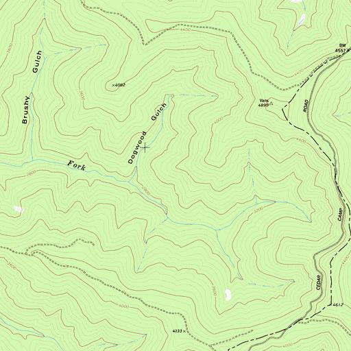
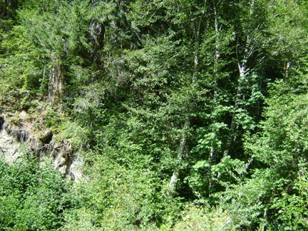
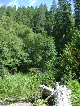
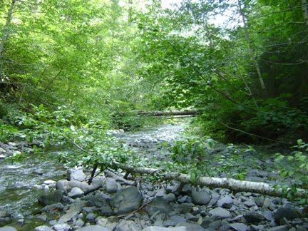
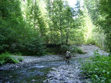
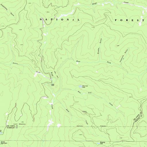
 We put on our knee-high river boots and started up the creek about a quarter of a mile at most to the bottom of what most consider the general Patterson-Gimlin Film Site. It's a big gulch with the creek running in two branches with big piles of logjam debris, fallen giant old-growth firs, and some large root balls (just like the ones in the "Big Bend" described by Bob Gimlin). In the map above you may see the lower film site right above the "A" and the road, where the small unnamed creek flows into Bluff Creek Some believe this is where Patty walked, but others believe it is in the smaller sand bar (white in the map) area right beyond there, just before the spot where the creek juts in a straight "bowling alley" line northward. We sought to explore both options, looking of course for "the big tree" seen in the film, or any other markers of verification.
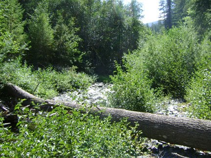
Images: Just below the film site, large fallen firs typical of the area. Below, trees above the lower film site.
 SEE OUR PREVIOUS BLOG ENTRIES HERE, HERE, HERE, HERE AND HERE for our earlier exploration of the film site. There is also A LOT of Bluff Creek and PGF information found in our extensive INTERVIEW WITH AL HODGSON, Willow Creek Bigfoot Elder, viewable here: PART ONE, PART TWO, and PART THREE.
Here we were interested in esoteric dimensions like trees, stumps, and sand types. We walked up the creek past the film site to investigate another sand bar up there at the top of the "bowling alley." When we headed back we crossed up onto the now quite elevated and forested sand/gravel bar, and walked across both prospective film site locations. BOTH are plausible, especially as they were obviously both part of one single sandbar, now greatly eroded with the creek down in a much deeper gulch than it was after the 1964 flood's deposits were washed away over the years.
 Since everyone seems to disagree slightly, and the older guys like John Green and Bob Gimlin can hardly recognize the significantly changed site, we may never be able to exactly locate the route and situation of the Patty trackway. Adding to that problem, there has been significant erosion of the creekbed, possibly taking away a large part of the former film site sandbar; and the familiar and distinct filmed trees in the background have either been toppled or logged, from all we can tell. John Green told us in an email today that he could not locate the "big tree" he remembered.
We'll present the rest of this part of our travelogue as images with brief captions. Again, there are a lot of photos of the film site on our earlier blogs (check the left hand links) that we don't have room to replicate here. Enjoy!
Lower PGF sandbar, with downed tree roots.
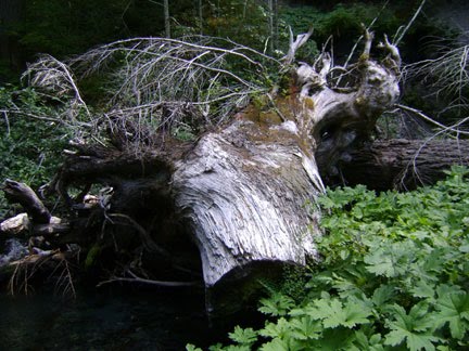
Root ball in "Big Bend" Gulch, just like Gimlin describes.
Film Site alder trees, like the ones Patty walks among.
Slanting alders with big firs visible in background, northern sand bar.The "soil" below is actually forest duff over deep deposits of dark blue-gray sand.
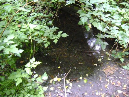
Marshy spring and pool on PGF site. Possibly accounting for the "wet spot" one sees in the first few frames of the film, often mistaken for the creek itself. This one is mid-sandbar.

Big Tree? This one is found at the northern back side of the sandbar, located up beyond the marshy spring. This is one of the largest, most obvious candidates for the tree, growing just up from the level sand/soil.
Just past the eastern edge of the PGF sandbar, looking north up the "bowling alley." Just above where Patty probably crossed the creek and headed up the hill above the site, as per Bob Titmus.
Straight on north, up the alley a bit farther.
At the top of the alley there is another nice looking prospective sandbar. From here the creek turns right on directly eastward. This is where we stopped.
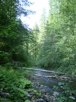
For perspective, here is one from one of last year's trips: looking up the gravel bar from the creekside at the site we feel pretty darn sure is the PGF site. Notice the large fir trees at the back. This would probably have been the embankment area Patterson ran up once crossing the creek, already filming.
***END OF PART ONE***
See the thrilling second part of the adventure next week, same time and channel!
 We would like to thank TopoQuest for making their nice, scalable maps of the area available. One may even click to center on a spot and get the GPS co-ordinates for it. Great! Check it out here:
Lonesome Ridge, California Topographic Map on TopoQuest
Here are the approximate co-ordinate we got in using the site. Your results may vary. The MK Davis site, as told to us by Weaverville researcher, Sean Fries, is 500 yards downstream from the "bat boxes."
Upper sand bar (Barackman location)
Map Center: N41.44069° W123.70039°
Daniel Perez' "X" (after Dahinden, as in Bigfoot at Bluff Creek)
Map Center: N41.44047° W123.70082°
Lower bar and gulch (as Christopher Murphy places it, and where Perez was seen walking around in 2003 and 2006)
Map Center: N41.43942° W123.70186°
Ferris Camp (historical) Locale [NEWS TO US!]
N41.44151° W123.70145°
Northern top of "Bowling Alley"
Map Center: N41.44347° W123.69975°
Bat Boxes (approximate) car/log landing
Map Center: N41.43854° W123.70453°
Datum: NAD27
USGS Map Name: Lonesome Ridge, CA Map MRC: 41123D6
Image: a broad view of the Bluff Creek basin, centered near Louse Camp. CLICK TO ENLARGE. Get the USFS Forest Atlas if you need better, more reliable road markings. Other one: from the Cibachrome of Patty. Enjoy!
*******************************************
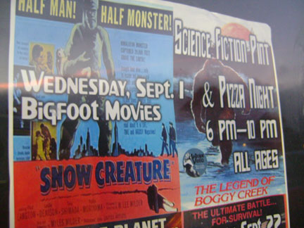
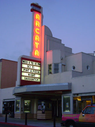 The ARCATA THEATER LOUNGE SCIENCE FICTION PINT AND PIZZA NIGHT, featuring SASQUATCH
This event was a pretty big hit, with a long line out the door at 6:00, constituting a nearly full house for viewings of THE SNOW CREATURE and then THE LEGEND OF BOGGY CREEK. Interspersed were give-aways of cryptic novelties like a Bigfoot Pez dispenser, hosted by Matt Jackson of MISSING LINK RECORDS and some Bigfooty film clips and songs assembled from our samples by event coordinator Mike Sargent. This was pop-culture Bigfoot with a twist: there was more than just the usual monster focus.
 We of BIGFOOT BOOKS had a book table in the back along with Patterson-Gimlin film subject casts brought along by James "Bobo" Fay. Bobo heroically appeared despite having had surgery just a day or two earlier. Attendee/customer questions proved to be generally sincere concerning the possibility of Bigfoot's existence, with only the slightest traces of mocking humor (though good-natured) from a few. There was, unfortunately, no time for the planned discussion panel.
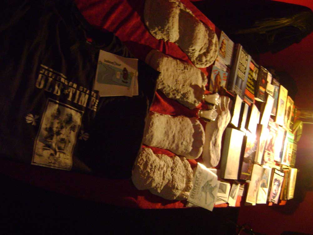 We sold a good bunch of Bigfoot books and maps, so we could tell interest was high, and pretty darn serious despite all the pints of strong beer consumed by the viewers (and the hosts). We are hoping that there will be a repeat of this event next year, perhaps with more non-fictional and serious content.
*******************************************
 Willow Creek's BIGFOOT DAYS 2010,
"Bigfoot's Nifty Fifty" Anniversary of the celebration, was really great and quite unusually Bigfooty this year. Watch for our next blog post for a complete pictorial coverage of the parade, and the decidedly less Squatchy celebration in the park afterwards. It was fun, for sure; but someday we are hoping that the organizing committee will actually go along with our suggestion that they add some Bigfoot speakers to the event. We suppose that most folks think that would be boring compared to reggae music, fireman's water competitions, axe-throwing, and sno-cones.
*******************************************
 ANGRY BIGFOOT SPEAKS!
Hu-man! Me real angry now. You give away all me secret hiding spot! Now where me go?
Wait until next week, Bigfoot!
Wha', Hu-man? What you talk?
We have pictures of where you live, Sasquatch!
Me not name Sa'quatch. That me trailer park trash brother. He like reach arm through trailer window, scare hu-man sitting on poop throne. You listen Bigfoot, hu-man. Me SMASH camera! Me STOMP compute machine! You go out to truck think drive to Bluff Creek? You find engine down hillside.
*******************************************